Geophysical Survey

Single & multi beam echo-sounders
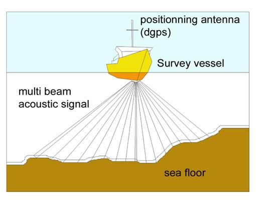
Principle

An echo-sounder measure the sea floor depth below sea surface.

Principle:

  • Single beam echo-sounder. It measures the double way transit time of an acoustic signal reflected on the sea bed. Water depth under the echo sounder base is computed knowing the sound velocity in water.
  • Multi beam echo-sounder. Acoustic signal is generated through a wide angular lateral aperture transducer. reflections of the lateral echoes of the sea bed are received from multiples narrow beams. Water depth are extrapolated along a wide band call swath. The swath width varies from 3 to 7 time the water depth.

Implementation and data processing

An accurate vessel positioning system is imperatively required (e.g. a DGPS). Several equipment type exist in this category : Sub bottom profiler, parametric echo-sounder, boomer, sparker.

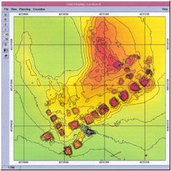
Gathered data is recorded, corrected from vessel attitude data, wave heave compensated and soundings are reduced from the tide and referenced to a reference level (chart datum, LAT, NGF etc..) A Digital Terrain Model (DTM) of the sea floor is built. Isocontours bathymetrical charts are computed and drawn.

Result

Seabed charting.
Geomorphological and sedimentological analysis of a site.
Requirement of bathymetric chart or data for structure foundation.
Survey of obstructions or existing structures.
Dredging control and cubature calculation.